LiDAR in Drone Survey
In drone survey missions, the choice between photogrammetry and LIDAR depends heavily on the exact application
Surveying missions with drones can give a wealth of information about the earth surface, buildings and infrastructure. Photogrammetry is a well known method to chart the earth surface, but with LiDAR equipment getting more powerful with less power consumption this methode can bring in vital 3D information.
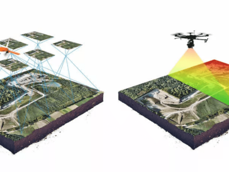
The company Wingtra is focussing on the usage of drones in survey operations. With precise GNSS navigation it is possible to map a ground sector with high accuracy. With today’s technology a unmanned drone can have a LidDAR payload and cover up to 10 km2 with an accuracy of 10 cm horizontal and 5 cm vertical.
Photometry give accurate and contextual information, what you see is what you get. The pictures can have a great resolution and will provide valuable information.
LiDAR is a scanning method, rotating mirrors send out a laser and the return time of that laser beam is the measurement that defines the picture.
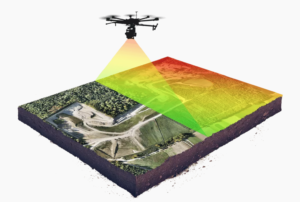
LiDAR uses oscillating mirrors to send out laser pulses in many directions so as to generate a “sheet” of light as the drone moves forward. Through measuring the timing and intensity of the returning pulses, it can provide readings of the terrain and of points on the ground.
LiDAR outputs are often colorised on the intensity of the reflection and can give valuable information on wood- or farm lands, the density of trees etc.
More information on LiDAR surveys with drones can be found at www.wingtra.com
 If you enjoyed this article, you will like the following ones: don't miss them by subscribing to :